
Search New Brunswick Streets by Address
A New Brunswick street directory search works best as a dated chain, not as a promise that one list names everyone on a road. Begin with the address as printed, including its suffix, and keep the postal city separate from the legal municipality. USPS can check the delivery line, while the state parcel tools can connect that line to a block and lot. From there, the county clerk index and dated directory entries can add a transfer party or historical occupant. Record the source date every time, because an annual tax file, recorded deed, and printed directory do not describe the same moment.
- Write down the street number, street name, suffix, municipality, ZIP, and any known block and lot. Retain the original wording if it came from an older record.
- Use the parcel or tax source to identify the address and save the parcel, tax-block, or lot reference that the official source supplies.
- Check the Middlesex deed index for conveyances and distinguish a deed from a mortgage, release, lien, easement, or map.
- For a dated registration lead, use the official New Jersey voter route or ask Middlesex election services about the lawful list-request process and the relevant election district.
- Compare a historical street section and alphabetical entry from a directory, then preserve its edition, year, and page with the parcel record.
Each New Brunswick step narrows the record type. A parcel is not a person list, a deed party is not necessarily an occupant, and a voter registration is a snapshot rather than proof of present occupancy.
Note: Keep the searched address, source date, and record relationship together so later checks do not turn separate evidence into one claim.
Set Up a New Brunswick Street Search
New Brunswick street work often begins by normalizing a record that was not written for a modern map. A directory can use “rear,” “above,” “corner,” “near,” or a landmark. A deed can describe a lot by its boundaries. A tax source may show the situs address, meaning the place where the parcel sits, while a notice can use an owner mailing line elsewhere. Put the printed address beside a normalized address rather than replacing it. This preserves the trail when a road name, house number, parcel, or postal label changed.
For each New Brunswick street directory entry, log the source custodian, record date, printed address, normalized address, parcel or case identifier, and the role actually shown. Use separate labels for occupant, owner, mailing address, grantor, grantee, organization address, and map label. That small distinction prevents a street listing from being treated as a complete personal profile. A modern campus, medical, civic, or institutional number may represent many offices or units, so a name attached to that number requires the source’s own unit detail before it can be connected further.
New Brunswick Parcel Search Fields
New Jersey Transparency property-tax data describes annual assessor-submitted information that can include location and owner, block and lot, assessed land and building value, prior taxes, and classification. It is a dated tax snapshot. A later transfer may not yet appear, and Daniel’s Law can remove protected owner names from public state parcel and tax material.
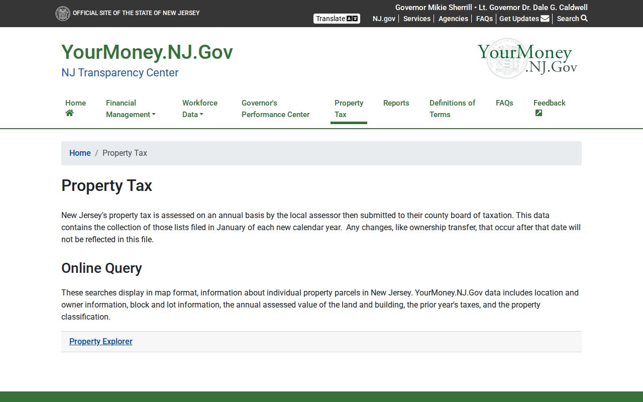
The property-tax screen is useful for connecting a New Brunswick address to parcel identifiers, but the clerk’s recordings remain necessary when the question is whether a later conveyance changed the title trail.
| Tool | Confirmed address concepts | Use with care |
|---|---|---|
| NJGIN Property Explorer | Address, county, municipality, block, and lot | Exact live control labels and result columns were not confirmed; protected owner names may be redacted. |
| NJ Transparency property data | Location and owner, block and lot, assessed land/building value, prior taxes, classification | Annual information can lag a later ownership change; no ZIP filter was confirmed. |
| Middlesex Parcels MapServer | Parcels and Tax Blocks layers; JSON, geoJSON, and PBF query formats | The service lists a 2,000-record maximum; popup fields and address-browse controls need live confirmation. |
Use the confirmed concepts as a checklist, not as invented form instructions. The New Brunswick research did not capture required fields, dropdown values, result sorting, export controls, or a city assessor result card. A blank owner field can reflect Daniel’s Law redaction, not the absence of an owner record.
New Brunswick GIS Street Layers
The Middlesex GIS program links its Open Data resources, mapping applications, static maps, NJGIN, and NJDEP. Its public parcel service separates Parcels from Tax Blocks. That difference matters in a street directory: a tax block is not the same thing as one parcel, and neither feature alone names a resident. The service advertises query formats but the inspection did not confirm which details appear in an interactive parcel card.
The Middlesex verified public-search login is the source for the next visual check.
This image shows the separate verified public-search login route, not a streetwide result list. A login screen is a reminder to verify which records, images, or copies require a distinct access route before relying on a search result.
Parcel boundaries may not edge-match statewide data, according to NJGIN. Capture the map date, the source layer, and whether the selected feature is a parcel, tax block, right-of-way, or building footprint. The public Middlesex Parcels MapServer is useful for that geographic layer, but it should not be presented as a census of people.
Check New Brunswick Deed Coverage
The Middlesex Record Search System states that deeds are available online from January 1, 1929 to the present, mortgages from January 1, 1950 to the present, and other documents from January 1, 1958 to the present. It advises trying spelling variants and lists access hours of 5 a.m. to 11 p.m., seven days a week. The county’s 2022 digitization notice says older deed books were digitized back to 1923. Treat 1923 through 1928 as a verification range, not a settled portal guarantee.
New Brunswick’s permit route supplies the next image.

The permit view shows an application route, not a searchable streetwide record list. It does not establish that every permit file is public or that a result identifies an occupant.
Search the party in both directions when working on a New Brunswick address. A grantee is a likely recipient in a conveyance, while a grantor is a likely transferor. Log the document type, recording date, instrument or book-page reference, municipality, legal description, and image or certification status if shown. A mortgage is not a conveyance, and a release is not a conveyance either. When the address is missing, a lot, block, subdivision, or metes-and-bounds description can bridge an older instrument to a current parcel.
Note: County staff can explain the computerized index, but the land-records page says they do not perform a title search for visitors.
New Brunswick Street Directory Records
The records below support a New Brunswick street directory from different angles. They should be compared, not collapsed. A tax snapshot can name an owner field when public; a recorded deed can name transfer parties; a map can show the lot; and a directory can preserve a dated occupant or institution listing. Permits can be useful address evidence if a requested file is released, but the city page inspected did not provide a public searchable permit or code-enforcement index.
| Address record | Custodian | Street-level value | Access route |
|---|---|---|---|
| Annual property-tax data | Local assessor / New Jersey Transparency | Parcel location, owner field when public, block/lot, values, prior taxes, classification | Public annual data; timing can lag and Daniel’s Law may redact owner names. |
| Parcel GIS and tax blocks | Middlesex GIS and NJGIN | Parcel geometry, block/lot, map context | Public service; exact parcel-card fields need live confirmation. |
| Deed and instrument index | Middlesex County Clerk | Grantor, grantee, dated instrument, legal-description trail | Web search and Bayard Street record room; date coverage varies by series. |
| Election registry records | New Jersey and Middlesex election offices | Address-related registration snapshot when lawfully available | Official lookup or election-list request; restrictions and dates apply. |
| Directories, maps, minutes | Library, Rutgers, State Library, and archives | Historical street context, occupant listing, street wording, map evidence | Scan, reference help, archive, or custodian route; cite edition and page. |
For streetwide election information, N.J.S.A. 19:31-18 says registry lists are organized by street, residence number, and name. The statute also limits signatures, and N.J.S.A. 19:31-18.1 restricts commercial or charitable solicitation use. The public lookup’s current field labels were not captured, so do not assume it accepts a street search. Middlesex election services describes a request and password workflow with Excel responses for several list types.
New Brunswick Street Names in Records
New Brunswick street names can outlast numbering, but neither is permanent. New Brunswick Common Council minutes from 1796 to 1819 and city ordinances from 1865, preserved through the New Jersey State Library Middlesex collection, can help explain public works, street naming, municipal services, and address context. They are not a ready-made resident index. Search by date and street name, then pair a municipal reference with the map, deed, or directory evidence that actually supports the address trail.
The Raritan River and the city’s wards, bridges, and port history also create older place references that may not match a current street search. For an older New Brunswick street directory entry, retain the original road, ward, ferry, neighborhood, or cross-street phrase. The legal description and record date can be more stable than a label that later changed. A title-page citation and a page number make a later archive check possible.
Note: A newer postal label or map name should be stored beside, not substituted for, the exact wording printed in a historical record.
Read New Brunswick Street Directory Terms
Address records use short terms that look alike but answer different questions. Define them before comparing a printed directory entry with a tax roll or recorded map.
- Parcel
- A mapped piece of land used in tax and property records. A parcel can change through a subdivision, consolidation, or recorded map.
- Situs address
- The place where the parcel sits. It can differ from the mailing line used for tax notices or other correspondence.
- Plat or recorded map
- A filed map that can show lots, blocks, survey details, municipal endorsement, and a filing date. It is not a current household list.
- Criss-cross directory
- A historical directory arranged by address or street, often used with an alphabetical section to compare a dated occupant entry.
A by-address record becomes more reliable when these terms stay separate. The recorded map may establish how a lot was created, while the directory records who or what was printed at an address in one edition. The tax list adds an annual property snapshot. None replaces the others.
New Brunswick Directory Entries by Street
The local historical trail includes four New Brunswick directories from 1855 through 1871 that were digitized in 2023 after physical damage. Read a street section from both ends, then compare the same address in the alphabetical index and in the next available edition. Look for number jumps, “rear” references, business and residence distinctions, multiple entries at one number, and missing years. The entry is evidence of a published snapshot, not a deed or a modern address confirmation.
The February 1897 Library of Congress New Brunswick Sanborn map contains 31 sheets. Used beside a directory and modern parcel layer, it can help identify a building footprint, stories, construction material, use labels, fire walls, and nearby street geometry. It cannot identify a current resident. For older address history, the New Jersey Historic Preservation Office’s house-history sequence brings together directories, deeds, tax ratables, maps, and atlases, while noting that some early ratables are incomplete.
Historical directories are covered in more depth in the New Brunswick directory book. Use that collection work to preserve the edition and page, then return to the street directory chain for the parcel and modern address comparison.
New Brunswick Address Permits Need Requests
New Brunswick city permit material offers application packets and inspection information, but the inspected city pages did not show a public address-search index. A permit file may identify an applicant, project type, inspection, owner, or date when the underlying record is released. It is not evidence of residence, and some code material can be sensitive or exempt. A focused request should name the address, date range, and project type instead of asking for a broad household file.
New Brunswick’s permit route is shown in the source image above. Its related right-of-way portal required confirmation of its live form, attachments, fees, status view, and public-browse capability. The city office, county clerk record room, library reference service, and archive route each hold different material. Follow the custodian rather than expecting a parcel map to contain every address record.
New Brunswick Street Search Limits
A New Brunswick street directory cannot identify every person connected with an address. Map browsing can enumerate parcel features, but it does not enumerate people. A deed party can be an investor, executor, trustee, corporation, lender, or relative rather than an occupant. A directory entry may refer to a boarder, business, institution, or past resident. Voter data is time-sensitive and may be inactive, stale, protected, or limited by the official request route. Utility customer information and motor-vehicle address data are not public street lists.
Daniel’s Law can redact covered people and households from hosted parcel and tax data. New Jersey’s Address Confidentiality Program also serves qualifying victims and survivors as well as reproductive-health patients and providers. A blank, withheld, or nonmatching result should be recorded as a limit, not treated as a reason to infer a person’s identity or current location.
When the goal changes from an address chain to verification of one named person, use the separate New Brunswick resident lookup route and preserve the same date, source, and evidence limits.